
Highlights of Annapurna Circuit Trek from Pokhara
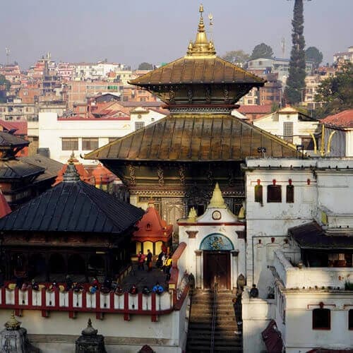
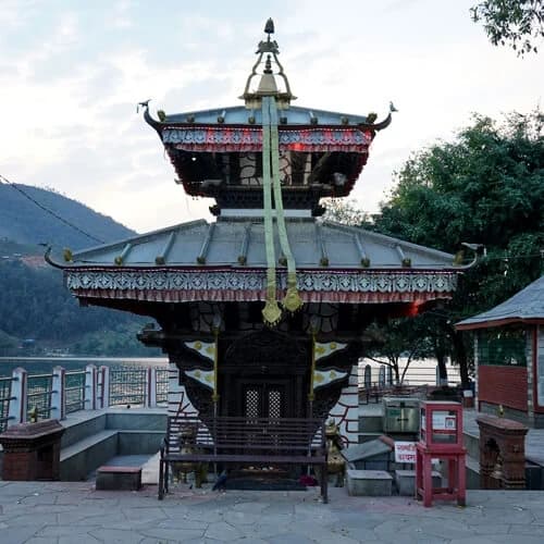
- Spend leisure time in Pokhara (822 m/2,700 ft), the serene lakeside city, exploring vibrant markets, relaxing at ambient cafes and restaurants.
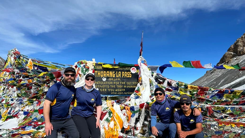
- Conquer the Thorong La Pass (5,416 m/17,769 ft), which is the climax of the trek, and reaching here is a moment of pure achievement and reward as you stand in awe with the 360-degree panorama of the Dhaulagiri 8,167 m/26,795 ft) and Annapurna I (8,091 m/26,545 ft).
- Marvelous views of Mt. Manaslu (8,163 m/26,781 ft), the world's 8th highest mountain, and peaks like Gangapurna (7,455 m/24,458 ft), Tarke Kang (7,231 m/23,724 ft), Khangsar Kang (7,485 m/24,557 ft), and many more mountains above 6,000 meters.
- A pre-dawn hike to Poonhill 3,210 m/10,531 ft) to witness a mesmerizing sunrise as the morning light illuminates the peaks of Annapurna in shades of yellow and golden hues.
- Visit the sacred Muktinath, which is home to 108 water spouts and an eternal flame. The temple is one of Nepal's holy pilgrimage sites for Hindu and Buddhist followers.
- A peaceful and calm hike from Dharapani to Chame following the Marsyandi River, passing through deep gorges, and crossing high-suspension bridges.
- Take a moment to relax and take pictures at Chyamche Waterfall and Rupse Waterfall.
- Trek alongside the astonishing Kali-Gandaki Gorge, the deepest in the world.
- Opportunity to witness wildlife like the Blue Sheep, Langur monkey, Yaks, Tahr, Himalayan Monal, Marmots, and the elusive snow leopard.
- Stay at traditional teahouses and experience the lifestyle and culture of the Gurung, Magar, and Thakali communities.
- Enjoy local delicacies on the trail, such as the Thakalai Khana set, Dhido, Gundruk, Thukpa, Tsampa, Butter Tea, and Rice beer.
- Experience the dramatic climate shift from dense forest to rugged high Himalayas as you ascend to Upper Pisang, which offers you a close-up view of Annapurna II (7,937 m/26,040 ft).
- Walk through the ancient, stone-built villages of Ngawal and Ghyaru to experience the panoramic views of the entire Annapurna range.
- Visit the 600-year-old Braka Monastery, explore its ancient Murals, and learn about the Tibetan Buddhist-influenced culture and heritage of the Manang region.
- Stop by Marpha Village and Brathang Village to explore the Apple orchard and try organic apple pies, dried fruits, and brandy.
- A rewarding hike to Ice Lake (Kicho Tal) to help your body adapt to the increasing elevation.
- Relax at Tatopani after days of trekking and soak your tired muscles in the rejuvenating sulfurous hot spring water.
Overview of the 11 Days Annapurna Circuit Trek from Pokhara
The Annapurna Circuit Trek is a high-altitude journey that encircles the magnificent Annapurna Massif of Nepal. This 11-day Annapurna circuit expedition is a shortened version of one of the legendary trekking routes in the Annapurna region, and covers approximately 160 to 230 kilometers depending on the itinerary. On every turn, you will have breathtaking views of 8,000-meter giants like Mt. Annapurna (8,091 m/26,545 ft) and Mt. Dhaulagiri (8,167 m/26,795 ft), Machhapuchhre/Fishtail 6,993 m/22,943 ft), and Tilicho Peak (7,134 m/23,406 ft).
It is moderately challenging and suitable for beginners of any age with a good fitness level. The ultimate goal of this trek is to reach the Thorong La Pass (5,416m / 17,769ft), the highest point. You will cross this adrenaline-pumping section with a sense of achievement and descend into the mystical Mustang region. The journey's unique aspect lies in its blend of cultural experiences and ecological diversity. Our 11-day journey begins in Pokhara, the beautiful lakeside city, and continues through suburban areas, towns, villages, grasslands, and forests into the Annapurna Sanctuary.
Along the way, you will come across and stay at traditional teahouses at villages like Chame, Manang, Tuckuche, Jomsom, and Marpha. It is an opportunity to observe the daily lives of the native people and to participate in their cultural activities during festivities. This makes the trek an excellent introduction to the rich cultural heritage and adventurous trekking routes of Nepal. Your journey begins in the lower valleys of the region, walking alongside the Marsyangdi River and passing through charming Gurung and Thakali settlements.
Moving on, you will arrive at remote villages like Ghyaru, Ngwal, and Braka, a tiny town near Manang. It is renowned for its historic, multi-story monastery, the Braga Gompa, one of the oldest in the region. The excitement does not end here as you descend towards Kagbeni (a medieval-looking village), Marpha (famous for organic apples), and finally Muktinath. This sacred temple is a revered religious site for both Hindus and Buddhists. It is believed that bathing in the 108 sprouts of Muktinath washes away sin and helps attain nirvana.
This 11 Days Annapurna Circuit Trek from Pokhara is more than just a hike; it is an emotional and spiritual pilgrimage. To make your journey more comfortable and immersive, we prioritize utmost safety, as our itinerary follows an anti-clockwise route (starting in the Marsyangdi River valley). This approach ensures gradual elevation gain and safer acclimatization, with crucial rest days in villages like Manang (3,540 m / 11,614 ft). The rest day also includes trips to the mesmerizing Gangapurna Glacial Lake or the tranquil Ice Lake (Kicho Tal). Additionally, with our licensed guide providing expert oversight throughout the journey, we can arrange a swift emergency helicopter rescue if needed.
Note: Before the trek officially begins, we will conduct a mandatory online trip briefing to ensure you are fully prepared and confident for your journey. During this essential session, your guide will thoroughly review the final travel plans, set clear expectations for the trail, and answer any questions you have about altitude, gear, or daily trekking schedules. This is your chance to clarify logistics before leaving Kathmandu.
Is the Trail from Yak Kharka (Letdar) to Thorong Phedi Safe?
The path to Thorong Phedi from Yak Kharka is safe; however, trekkers can be at risk if they are careless at hazardous sections. It is a short hike, but it is a crucial day because you will be ascending above 4,500 meters (14,800 ft). After you leave Yak Kharka, you will reach an area where the path passes through a potential landslide zone. The distance is short, but the trail is narrow, so careful footing and navigation are needed to avoid slips and falls. It is strongly advised that you do not linger in these sections, maintain a safe distance from others, and follow our trek guide's lead.
Astonishing View from the Thorong La Pass: An Ultimate Triumph
The Thorong La Pass is the highest point of the 11-Day Annapurna Circuit Trek. This is where the emotional and physical effort during the journey finally pays off. The hike begins early at 4 AM to avoid the powerful winds that set in later in the day. You will navigate the terrain with headlamps, trekking poles, and crampons to prevent slips and falls during the ascent. We advise you to wear a three-layer system of clothing to protect yourself from cold snow and icy winds as temperatures drop below -10 degrees Celsius.
The ascent to the pass is a demanding 4- to 5-hour trek through uneven snow-covered terrain. You should maintain a steady pace and take 5 minutes of rest every 30 minutes to help your breathing recover. Finally, at the top, you will be welcomed by hundreds of prayer flags fluttering in the wind, which mark your triumph over the challenging segment of the Annapurna Circuit Trek. You are rewarded with the breathtaking panoramic views of the Dhaulagiri and Annapurna mountain ranges. It is a monumental achievement, which will be a memorable part of your journey for a lifetime.
Is the 11-Day Annapurna Circuit Trek from Pokhara Suitable for You?
Trekking the Annapurna Circuit in 11 days is a fantastic choice if you are seeking a high-altitude challenge, but are limited on time. This itinerary is designed to maximize your travel experience by focusing on the rewarding section of the classic Annapurna Circuit Trek. We recommend this high-altitude journey to fit and healthy individuals with no underlying conditions that might affect mobility.
You must be able to walk 5 to 7 hours and cover approximately 10-15 km per day with a daypack. Additionally, anyone can participate in this trek regardless of their age. We have had previous clients aged 10 to 75 who have completed the Annapurna Circuit Trek and similar high-altitude adventures in Nepal. If you have any requirements to adjust the itinerary to suit your preferences better, we can also tailor it with additional rest days on the trail.
The Risk of Altitude Sickness and How to Prevent It
As the trek reaches elevation above 4,500 meters, with the highest point being at Thorong La Pass, you will be at potential risk of Acute Mountain Sickness (AMS) or Altitude Sickness. It is a pathological condition that occurs when your body cannot adapt to the changing atmospheric pressure in the Himalayas. Some of the early signs of the illness include:
- Headache, Lightheadedness, Dizziness
- Nausea, Vomiting
- Tired, Fatigue
- Shortness of breath
- Insomnia, Loss of appetite
If you experience any of these symptoms, you must inform your guide immediately, who will then follow the "descend immediately" protocol. This step is crucial as it allows quick recovery and effectively restores the body's oxygen supply. Although the illness can affect anyone regardless of their fitness level or age, you must abide by specific rules to prevent it effectively, such as:
- Always hike at a slow and steady pace on the trail.
- Take Diamox under the prescription of a healthcare professional.
- Do not rush the trek, and avoid gaining 300 to 500 meters of elevation above 3,000m per day while sleeping.
- Take periodic rest when you feel tired to catch your breath, and sleep for at least 8-10 hours.
- Drink 2 to 3 litres of water daily, and avoid nicotine, caffeine, and alcohol.
- Eat carbohydrate-rich foods like rice, potatoes, and lentils.
- Drink natural remedies like ginger tea and garlic soup to soothe your body during lunch breaks.
Note: Our guides have years of experience on the trail and will notice the first sign of altitude sickness. You must listen to your body and seek immediate medical attention and transport to the nearest health facility.
Trek the Annapurna Circuit with Certified Expert Guides
One of your most significant concerns when beginning an adventure on the Annapurna Circuit is always safety, altitude anxiety, and navigation. This is precisely why your journey is led by Government-Licensed experts like Sanjaya Adhikari or Indra Khadka, who will ensure it is worry-free. Our guides are highly trained professionals, certified by the Nepal Academy of Tourism and Hotel Management (NATHM), ensuring they meet industry standards in knowledge, language proficiency, and service.
To ensure your safety on the trail, they have been trained in Wilderness First Aid (WFA), and are well-knowledgeable about Acute Mountain Sickness (AMS) recognition and protocol. The guides will be assigned with a ratio of (1 guide for every 4-5 clients), with additional assistant guides if the group is bigger. They will constantly monitor your pace and check your vitals, such as heart rate and blood oxygen saturation, with an oximeter daily. This proactive safety commitment allows you to relax and focus on the majesty of the Himalayas.
Additionally, your guide is an integral part of your journey, as they are more than just navigators; they are cultural mediators as well. The guides will help you understand and learn about the local customs and traditions of the Gurung and Thakali communities. Furthermore, they will handle all logistics, including booking your trail accommodations, ordering food, making itinerary adjustments, and managing porters. By placing these critical responsibilities in the hands of a knowledgeable, strong English-speaking professional, you are guaranteed an immersive, successful, and fully supported journey.
Safety Protocols on the 11 Days Annapurna Circuit Trek from Pokhara
Our safety is our priority, and confidence in beginning a high-altitude trek like the Annapurna Circuit comes from transparency and expert planning. Below is a summary of the core safety protocols we build into your itinerary to address your anxieties about emergency response, altitude, and unpredictable weather.
- High-Altitude Insurance: We require you to have travel insurance that explicitly covers trekking and emergency helicopter rescue up to 5,000m. This is the essential financial safety net that guarantees immediate air transport to a medical facility in Kathmandu in the event of a critical health issue (such as severe AMS, injury, illness, or other emergencies).
- Permits Secured: We handle securing your official licenses, such as the Annapurna Conservation Area Permit (ACAP), ensuring your legal and authorized passage through all checkpoints on the trail.
- Route Assessment: Your guide decides whether the route you will be traveling on is safe, which is crucial during unpredictable weather conditions. You will be advised to wear microspikes or crampons during the ascent to Thorong La Pass if the route is covered in thick layers of ice and snow.
- Avoid heavy baggage: By hiring professional porters, you only have to carry your daypack. This significantly reduces physical strain, prevents injuries, and conserves the energy needed to manage the high altitude safely.
Why Trek with Outfitter Nepal?
Choosing the right operator for your next adventure is one of the most critical decisions for a safe and successful travel experience. With Outfitter Nepal, you benefit from our 15 years of operational experience in the Himalayan region of Nepal. We are a locally owned company with no third-party agents, allowing you to offer transparent, lowest-cost pricing with no commission fees.
The services we offer are industry-standard, and our reliability is verified through our active affiliations with governing bodies such as the Nepal Tourism Board (NTB), the Trekking Agencies' Association of Nepal (TAAN), and the Nepal Mountaineering Association (NMA). Over the years, we have conducted hundreds of treks and tours with a 95% success rate. Our commitment to personalized services and hospitality is proven by the fact that over 60% of our trekkers are repeat clients.
The true testament to our quality is our guides and staff members, who dedicate themselves to ensuring a higher caliber of service, logistic handling, and safety protocols. In the event of an emergency, we are available 24/7 to mobilize a helicopter rescue, offering you complete peace of mind. You can read through the experiences and reviews of our previous clients on TripAdvisor, Google, and YouTube. These are verifiable social proofs that confirm our reliability and commitment to providing unforgettable, safe, and custom-tailored trekking experiences for tourists of all ages.