Annapurna Circuit With ABC Trek - 22 Days

Explore the Best Combine Treks to Annapurna Circuit With Base Camp Trek - 22 Days
Annapurna Circuit With ABC Trek
facts icon
What to see & do
Specific information about Annapurna Circuit With ABC Trek - 22 Days
duration icon
Duration22 Days
grade icon
Trip GradeStrenuous
i
altitude icon
Max Altitude5416M
start icon
Starts atKathmandu
end icon
Ends atKathmandu
travel-style icon
Travel StyleLodge to Lodge Trek
group-size icon
Group Size10
transportation icon
TransportationLocal and Tourist Vehicles
cloud-sun-rain icon
Best SeasonMarch, April, May and Sept, Oct, Nov

Annapurna Circuit with ABC Trek 22 Days is the ultimate trekking adventure in the Annapurna region. Perfect for avid trekkers, this extensive trekking route takes you to the three most popular trekking destinations of the central Himalayas: Annapurna Circuit, Poonhill Trek, and Annapurna Base Camp.

Starting from Bhulbule, you'll walk around the Annapurna massif as a part of the Annapurna Circuit, passing by the Buddhist villages of Chame, Pisang, and Manang, decorated with Mani walls and prayer flags and crossing the challenging Thorung La Pass. Once you reach Muktinath and pay a visit to the holy Muktinath Temple, you divert from the original Annapurna Circuit Trekking and drive to Tatopani instead. This reduces the itinerary by a few days without missing anything crucial.

Here begins the next leg of the Annapurna Circuit and Annapurna Base Camp - Ghorepani Poonhill Trail. You'll resume your trekking journey from Tatopani, taking a steep ascent to Ghorepani. The taxing hike day is followed by a rest day in the Magar village of Ghorepani, giving you the perfect opportunity for another highlight of the trek, a pre-dawn hike to Poonhill for glorious Himalayan sunrise. The trail continues toward Tadapani with a panoramic view of the Annapurna range. Consider yourself lucky if you're hiking during March and April because the Rhododendron forest turns bright red, pink, and white with fresh flower blooms along the trail.

Leaving the Ghorepani-Poonhill trail behind, we move ahead to the small village of Chhomrung and join the standard Annapurna Base Camp trekking route. Passing by small Gurung settlements and Machhapuchre Base Camp, we finally reach Annapurna Base Camp in the glacial basin of Annapurna Sanctuary, the last destination of our 22 Days Annapurna Circuit with Annapurna Base Camp Trek. After spending the night at the base of the Annapurna massif, we hike back to Matque via Bamboo and drive to Pokhara.

Let us take you through the virtual tour of the major highlights of the Annapurna Circuit with Annapurna Base Camp 22 Days for a clear idea of what you're signing up for. This strenuous trekking trip is full of challenges, but the following details definitely make it worthwhile.

Best Features of the Annapurna Circuit with ABC Trek

  • Cover 3 treks of the Annapurna Region in 22 days
  • Thrilling yet scenic drive from Kathmandu to Bhulbhule and Muktinath to Tatopani
  • Standing at the base Camp of Annapurna I, the world's 10th-tallest mountain peak
  • Crossing the taxing Thorung La Pass at 5416 meters, the highest point of the trek
  • Surround yourself with 7000+ meters high mountains
  • Visiting Muktinath Temple, a sacred temple of Hindus and Buddhists in rural Mustang
  • Relax the sore muscles at a hot water spring in Tatopani
  • Witness the mesmerizing sunrise view of the Himalayan panorama in Poonhill
  • Staying with the humble locals from Gurung, Magar, Thakali, and Manage ethnicities
  • Trek across varied climatic regions, including tropical, alpine, and high-altitude desert

3 weeks of trekking in the wild Annapurna Himalayas

As cool as it sounds, spending 3 weeks in the wilderness of the deep Himalayas is certainly a life-changing experience. The hard-core trekking adventure in the rugged high-altitude terrain, sometimes exceeding 5000 meters above sea level, tests your limits. No matter how high you ascend, the giant mountains keep you grounded. It's going to be tough. You might even feel like giving up in the face of the cold mountains. But imagine the moment when you actually complete the trek; you'd be so proud of yourself. You'll feel invincible.

Staying overnight at the base of the world's 10th-tallest mountain peak

Once you're in close proximity to the majestic Annapurna, you'll forget all the discomfort you felt as you ascended through the challenging and rocky Himalayan landscape. You experience euphoria as you gaze out over the mountain scenery from Annapurna Base Camp (4130 m). As opposed to EBC, you can stay at the ABC, and the glorious sunrise in the morning is something to wait for. Even though it's freezing outside, the atmosphere in the teahouse is warm and cozy, with trekkers sharing their hiking tales.

Walking by the highest trekking pass, Thorung La Pass, at 5416 m

The towering Thorang La Pass sits at the height of 5416 meters between the peaks of Khatung Kang and Yakwa. Given that you must go along a rocky, steep trail to reach the top of the pass, it is considered the most difficult hike in the area. You'll feel as though your dedication and hard work were justly rewarded when you finally reach the top and see the breathtaking panorama of the neighboring mountains. It is impossible to adequately express the sense of achievement you feel after soaking in the beautiful vista from the pass.

Breathtaking views of 7000+ meters of mountains surrounding you

It goes without saying that you will see the Annapurna range's mountains during the Annapurna Circuit with Base Camp Trek of 22 days. This 55-kilometer-long massif is home to many peaks, including Annapurna (8091 m), Machhapuchhre (6993 m), Gangapurna (7455 m), Nilgiri Himal (7061 m), Tilicho Peak (7135 m), and others. You'll also get to witness Mt. Dhaulagiri (8167 m), Mt. Manaslu (8163 m), Mt. Lamjung Himal (6986 m), and other mountains in the distance. In fact, you'll find mountains with snow on top all around you.

Vegetation ranging from tropical to alpine to high-altitude desert

The unique 22 days trek of Annapurna Circuit and Base Camp begins in the subtropical landscape of green forests and rivers flowing with gushing sounds. You trek past innumerable terraced paddies and farms while enjoying the warm weather. Within a few days, the alpine vegetation with arid slopes and dismal ravines surrounded by snow-capped mountains comes into view. After crossing Thorung La Pass, you'll enter the desert-like landscape with dry soil void of any vegetation. You'll again drive down to the tropical vegetation before ascending to the Annapurna Base Camp.

Seek blessings from the holy Muktinath Temple

At the foot of Thorong La Pass lies Muktinath Temple, one of the most revered Hindu and Buddhist pilgrimage sites. It is believed that visiting Muktinath Temple, known as Mukti Kshetra (place of liberation), will absolve you of all your sins and bring you luck. Thousands of pilgrims travel to the temple from different regions of India and Nepal to bathe in the temple's pond and the taps. The 22-day Annapurna Circuit with Base Camp Trek is a fantastic opportunity to pray for blessings for yourself.

Mesmerizing sunrise view from Poonhill

Ghorepani-Poonhill is a different trekking trail well-known for its breathtaking sunrise view against the distant mountains. The panoramic view of the Annapurna Range, along with Mt. Machhapuchre and Dhaulagiri, lights up in the golden hue of glorious Himalayan sunrise. This magnificent scenery is visible from the hilltop Poonhill, which is just a short uphill hike from Ghorepani. Including this trail in our 22-day Annapurna region trek is a cherry on top.

Dip in the natural hot spring of Tatopani

During the Annapurna Circuit with ABC Trek of 22 days, we pass by Tatopani (translated to "hot water" in Nepali), which has a hot spring in the area. It is thought that spring water has a unique ability to heal and soothe aches and pains. Taking a hot spring bath is said to cleanse the spirit as well. Thus, we recommend you soak in the hot spring briefly before ascending to Ghorepani.
Itinerary
Trip day to day detail itinerary
Expand all

As you land at Tribhuvan International Airport in Kathmandu, our airport representative will be waiting to receive you. They will transport you to a 3-star hotel in Thamel, Kathmandu's lively and touristy area with plenty of hotels, restaurants, cafes, bars, and pubs. It is favored by most tourists and trekkers to stay because of its location, which happens to be at the city center.

You can relax after checking in to a room at your hotel or take a tour around the neighborhood. There are many hiking equipment stores on the streets of Thamel, so it is a good time to purchase any that you may need. Make sure to overcome your jetlag with a good night's sleep in order to be ready for the adventure the next day.

  • max-altitude iconMax. Altitude: 1350m/4,429ft
  • accomodation iconAccommodation: 3 Star Hotel
  • transportation iconTransportation: Private Vehicles

At about 7 AM, your trek guide will pick you up from the hotel and take you to the bus station for Besisahar. Make sure to have your breakfast and get ready by 7 in the morning. The comfortable bus ride takes you along Kathmandu-Pokhara Highway till Dumre and then takes a right turn to head towards Besisahar. The road after Dumre is narrow, and the drive is thrilling as you glide over a paved path with the Marshyangdi River by your side. You get down in Bhulbhule, where you'll be staying tonight.

  • max-altitude iconMax. Altitude: 845m2/2,772ft
  • meal iconMeals: Breakfast, Lunch and Dinner
  • elevation-loss iconElevation Loss: 505m/1657ft
  • accomodation iconAccommodation: Mountain Lodge

After breakfast at the lodge in Bhulbhule, we begin our 6-hour hiking journey to Chamje. Initially flat, the trail soon rises sharply, with the way carved out of a sheer rock face 200-300 meters above the riverbed. We eventually make our way down to Jagat (1300 m), which is situated on a shelf that protrudes into the treacherous Marsyangdi valley. The trail now notices minor ascents and descents to Chamje through the woodlands.

  • max-altitude iconMax. Altitude: 1,430m/4,692ft
  • meal iconMeals: Breakfast, Lunch and Dinner
  • elevation-gain iconElevation Gain: 585m/1,919ft.
  • accomodation iconAccommodation: Mountain Lodge
  • walking-hour iconWalking Hours: 6-7 hours
  • walking-distance iconWalking Distance: 19km/11.8mi

Following a hearty breakfast at the guest house, we begin our walk by descending to the river and crossing another suspension bridge. Next, we begin the ascent to Sattale (1550 m), which is up a slope that is so steep that it seems one slip may send you tumbling down the valley.

We continue on a route that winds above the river. At one point, when a tributary enters from the opposing bank, the main river is obscured by enormous stones.

After ascending a winding path to the hill's summit, the level plain of Tal (1700 m) will be visible. After Tal, the valley narrows, and the trail twists high and, in some places, sculpted directly from the rock. Before the trail descends again to the river and we pass a second suspension bridge to reach Dharapani, we must continue walking along the cliffs beyond the small settlement of Karte (1900 m).

  • max-altitude iconMax. Altitude: 1,860m/6,102ft
  • meal iconMeals: Breakfast, Lunch and Dinner
  • elevation-gain iconElevation Gain: 430m/1,411ft.
  • accomodation iconAccommodation: Mountain Lodge
  • walking-hour iconWalking Hours: 5-6 hours
  • walking-distance iconWalking Distance: 14km/8.7mi

Starting the hike day from Dharapani, we move towards a narrow grassy field. As the Marsyangdi River turns to the left, the Annapurna II becomes apparent in the distance. Then you reach Bagarchhap, a Bhote village with a Buddhist monastery nearby, where the prayer flags are seen waving flirtatiously in the breeze.

We ascend farther through pine and oak forests, walking past Danaque (2210 m). We reach the settlement of Timang, located at the base of Lamjung Himal, after crossing a short wooden bridge and a challenging rise. The trail after that is flat until we arrive at Chame, where we spend the night.

  • max-altitude iconMax. Altitude: 2,670m/8,760ft
  • meal iconMeals: Breakfast, Lunch and Dinner
  • elevation-gain iconElevation Gain: 810m/2,657ft.
  • accomodation iconAccommodation: Mountain Lodge
  • walking-hour iconWalking Hours: 5-6 hours
  • walking-distance iconWalking Distance: 15km/9.3mi

After breakfast at the guest house, we begin our hike to Pisang. The view of Lamjung Himal (6893m) sparkling in the early morning sunlight warms you to the core. The mountain vanishes as we ascend the path up the valley, passing a large apple orchard.

The valley begins to incline steeply as we continue on the path to Bhratang (2950m). After a brief ascent from Bhratang, we arrive at a rock-strewn area. Here, we cross a wooden bridge and proceed along a steep, curving trail.

Once more, we hike through a pine forest, and the valley's V-shape turns to a gradual U-shape, revealing a fantastic view. We then reach the lower settlement of Pisang, marked by a long Mani Wall near a bridge.

  • max-altitude iconMax. Altitude: 3,200m/10,498ft
  • meal iconMeals: Breakfast, Lunch and Dinner
  • elevation-gain iconElevation Gain: 530m/1,738ft.
  • accomodation iconAccommodation: Mountain Lodge
  • walking-hour iconWalking Hours: 6-7 hours
  • walking-distance iconWalking Distance: 16km/9.9mi

We begin our day from Pisang by ascending a high ridge that offers excellent views of the Manang valley and Tilicho summit (7145 m). As we descend past the airport for Manang at Humde (3320 m), we reach a flat region from where the northeast face of Annapurna III soars majestically above us. Annapurna IV (7525 m) is also evident from the broad plains of the Sabje Khola Valley.

Shortly past this, we take a wooden bridge across the Marsyangdi River to reach the small settlement of Mungji. On either side of the trail, you can see fields planted with some crops by the locals. Then, we see the village of Braga with its magnificent monastery, numerous enormous chortens, and Mani walls, all in front of which are the majestic Himalayan peaks. We arrive at Manang shortly after a strenuous ascent.

  • max-altitude iconMax. Altitude: 3,540m/11,614ft
  • meal iconMeals: Breakfast, Lunch and Dinner
  • elevation-gain iconElevation Gain: 340m/1,115ft.
  • accomodation iconAccommodation: Mountain Lodge
  • walking-hour iconWalking Hours: 6-7 hours
  • walking-distance iconWalking Distance: 16km/9.9mi

It is crucial to acclimatize well before crossing the Thorung La Pass. Manang is a perfect location for acclimatization as it has optional day hikes, such as crossing the river to view the massive icefall descending from the Annapurnas or ascending well beyond the village to get a full view of the Annapurna range and the Manang Valley.

Visiting the Himalayan Rescue Association [HRA] aid post in Manang is also worthwhile and educational. You can also go to Ganagapurna Glacier Lake to add some varied experiences to your rest day.

  • max-altitude iconMax. Altitude: 3,540m/11,614ft
  • meal iconMeals: Breakfast, Lunch and Dinner
  • accomodation iconAccommodation: Mountain Lodge

After a deserving rest day, you wake up in Manang feeling all pumped up to conquer Thorung La Pass, although we'll only make it to Yak Kharka today.

The trail slowly rises up from Manang to Yak Kharka, passing via the settlement of Gunsang (3960 m). We will hike all day while taking in the expansive mountain views surrounding us. Even though it seems like a short trek, the altitude will make us feel fatigued. We ascend even higher (4050 m) into the air with less oxygen, which makes breathing difficult. So, we move slowly and steadily.

  • max-altitude iconMax. Altitude: 4,050m/13,287ft
  • meal iconMeals: Breakfast, Lunch and Dinner
  • elevation-gain iconElevation Gain: 510m/1,673ft.
  • accomodation iconAccommodation: Mountain Lodge
  • walking-hour iconWalking Hours: 4-5 hours
  • walking-distance iconWalking Distance: 10km/6.2mi

Our quest for Thorung La Pass continues today with a hearty breakfast in Yak Kharka.

We start out by slowly climbing up to a hilltop, then descend to the headwaters of the Marsyangdi and cross over on a hidden wooden bridge. You first ascend the mountain way on the right bank of the Marsyandgi for a few distances before rising a treacherous hill on a small path and eventually descending to Thorung Phedi.

  • max-altitude iconMax. Altitude: 4,450m/14,600ft
  • meal iconMeals: Breakfast, Lunch and Dinner
  • elevation-gain iconElevation Gain: 400m/1,312ft.
  • accomodation iconAccommodation: Mountain Lodge
  • walking-hour iconWalking Hours: 3-4 hours
  • walking-distance iconWalking Distance: 9km/5.6mi

Today is the day we all have been waiting to cross Thorung La Pass, the highest point of our Annapurna Circuit with Base Camp Trek. We start our hike early in the morning on a challenging but clearly marked track to Thorang La Pass (5416 m). The slope eventually flattens out. We reach the prayer flags and chortens of the famed pass after 4 hours of steady climbing.

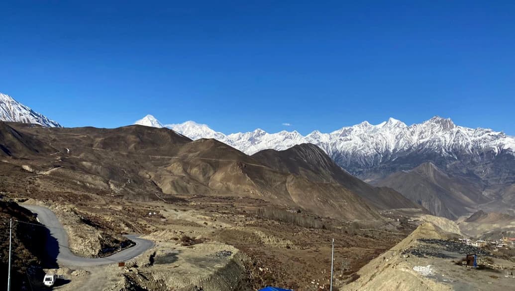
Dramatic vistas of Mustang's brown and purple hills spread out before us, as well as the snow-capped mountains at the top of the Kali Gandaki valley. The magical view around you as you stand at the top of the Thorung La Pass melts your heart with joy and accomplishment.

After a brief admiration for the insanely beautiful Himalayas, we head down toward Muktinath, which is an excruciating 1600 m descent, but the clear view of Dhaulagiri makes it all worth it. The grassy slopes eventually replace the moraines, then it is a delightful stroll up the Jhong Khola Valley to Muktinath.

  • max-altitude iconMax. Altitude: 5,416m/17,769ft
  • meal iconMeals: Breakfast, Lunch and Dinner
  • elevation-gain iconElevation Gain: 966m/3168ft
  • accomodation iconAccommodation: Mountain Lodge
  • walking-hour iconWalking Hours: 7-8 hours
  • walking-distance iconWalking Distance: 16km/9.9mi

First thing in the morning, you will visit the infamous Muktinath Temple and seek blessings for yourself and your loved ones. You will then return to the lodge for breakfast and prepare for a 4-5 hour drive to Tatopani.

Tatopani has a hot water spring which is believed to heal aches and pains. After checking in to the lodge at Tatopani, you can go to the hot spring and take a bath to ease your body after the demanding journey of 12 days.

  • max-altitude iconMax. Altitude: 1,190m/3,904ft
  • meal iconMeals: Breakfast, Lunch and Dinner
  • elevation-loss iconElevation Loss: 2,570m/8,431ft.
  • accomodation iconAccommodation: Mountain Lodge

Following breakfast at the lodge, we begin our trip by walking through a flat surface for a while. The trail then starts climbing sharply for at least an hour, passing through several villages with residents of various ethnicities and plenty of agricultural lands. The families of Gorkhalis who work for the Indian army make up the majority of the population here.

The trail then gradually climbs to Ghorepani while passing through a number of tiny settlements, including Phalate, Chitre, and others. You hike past rhododendron forests and may encounter many species of wildlife while admiring the expansive panoramas of several mountains surrounding you.

  • max-altitude iconMax. Altitude: 2,860m/9,383ft
  • meal iconMeals: Breakfast, Lunch and Dinner
  • elevation-gain iconElevation Gain: 1,670m/5,479ft.
  • accomodation iconAccommodation: Mountain Lodge
  • walking-hour iconWalking Hours: 6-7 hours
  • walking-distance iconWalking Distance: 18km/11.2mi

We take another rest day at Ghorepani, which is also the last rest day until we complete the entire Annapurna Circuit with Base Camp Trek. However, we don't spend the entire day relaxing at the lodge. We go for a sunrise hike to Poonhill, another highlight of the trek.

After an hour of hiking pre-dawn, we reach the hilltop Poonhill, an excellent viewpoint well-known for its breathtaking sunrise. The warm hue of golden sunrise reflecting from the snow-covered Annapurna range, Mt. Machhapuchre, and Mt. Dhaulagiri mesmerizes you.

Magar people majorly inhabit Ghorepani, and for the remainder of the day, you can interact with the locals, initiate conversations with the kids and spend a relaxing day enjoying a panorama of mountains.

  • max-altitude iconMax. Altitude: 3,210m/10,531ft
  • meal iconMeals: Breakfast, Lunch and Dinner
  • elevation-gain iconElevation Gain: 370m/1213ft
  • elevation-loss iconElevation Loss: 370m/1213ft
  • accomodation iconAccommodation: Mountain Lodge
  • walking-hour iconWalking Hours: 1 hours
  • walking-distance iconWalking Distance: 1.5km/0.9miles

After a warm breakfast at the lodge in Ghorepani, you will hike up and down several hills to finally reach Tadapani. It is a tiny settlement with only a few teahouses in the middle of a forest. On the way, you pass by Rhododendron forests which light up with red, pink, and white flowers in spring. You can still see the mountain panorama at a distance from the trail.

  • max-altitude iconMax. Altitude: 2,630m/8,628ft
  • meal iconMeals: Breakfast, Lunch and Dinner
  • elevation-loss iconElevation Loss: 230m/754ft
  • accomodation iconAccommodation: Mountain Lodge
  • walking-hour iconWalking Hours: 5-6 hours
  • walking-distance iconWalking Distance: 15km/9.3mi

After breakfast at the tea house in Tadapani, we finally depart on our trek towards the Annapurna Base Camp. You'll enjoy the gradual descent through rhododendron, oak, and other types of lush forests with soothing sounds of birds chirping.

The trail first leads you to Kimrung Khola. The next step is a sharp ascent, followed by 45 minutes of flat walking with a few modest inclines to reach Chomrong, the entrance to Annapurna Base Camp. Chomrong is where we spend the night.

  • max-altitude iconMax. Altitude: 2,170m/7,119ft
  • meal iconMeals: Breakfast, Lunch and Dinner
  • elevation-loss iconElevation Loss: 460m/1509ft
  • accomodation iconAccommodation: Mountain Lodge
  • walking-hour iconWalking Hours: 5-6 hours
  • walking-distance iconWalking Distance: 14km/8.7mi

We begin our journey after eating a delicious breakfast at the lodge. The trail initially drops on stone stairs for an hour and a half before crossing the Chhomrong Khola on a suspension bridge and climbing out of the side valley. The trail winds through bamboo, rhododendron, and oak forests high above the Modi Khola on its west bank.

After continuing up a rocky path, we will reach Sinuwa (2350 m). From there, we will gently hike through the forest before descending a long, steep stone stairway into deep bamboo and rhododendron forests to reach Bamboo. From there, we gently hike up towards Dovan and finally arrive at Himalaya.

  • max-altitude iconMax. Altitude: 2,920m/9,580ft
  • meal iconMeals: Breakfast, Lunch and Dinner
  • elevation-gain iconElevation Gain: 750m/2,461ft.
  • accomodation iconAccommodation: Mountain Lodge
  • walking-hour iconWalking Hours: 4-5 hours
  • walking-distance iconWalking Distance: 12km/7.5mi

The valley opens and grows less steep as we begin the hike. The trail continues to the Annapurna Sanctuary, crossing two avalanche trails on a scrambling, cliff-hugging path. Following a little hike, we will arrive at Bagar (3310 m), a lush meadow with a few deserted hotels. The trail travels along the valley's left side for a while and gradually climbs to Machhapuchare Base Camp (3820 m), where we take in some of the most beautiful scenery of Annapurna, Gangapurna, Machhapuchre, and Hiunchuli.

After hiking through the alpine meadows for some time, our trail ascends. We then have a short climb to reach Annapurna Base Camp. At the foot of the tenth-highest peak in the world, you will savor a delicious Nepalese meal before retiring to bed.

  • max-altitude iconMax. Altitude: 4,130m/13,549ft
  • meal iconMeals: Breakfast, Lunch and Dinner
  • elevation-gain iconElevation Gain: 1,210m/3,969ft.
  • accomodation iconAccommodation: Mountain Lodge
  • walking-hour iconWalking Hours: 6-7 hours
  • walking-distance iconWalking Distance: 15km/9.3mi

We get up early and go to the Annapurna Sanctuary for sunrise. The sanctuary is a glacial basin surrounded by the peaks of Gangapurna, Hiunchuli, Annapurna South, and Annapurna I, the tenth-highest mountain in the world. Appreciate being close to peaks that rise to 8000 and 7000 meters, take some pictures, and head back to the tea house. After a quick breakfast, we prepare for our hike back.

Hiking down the same trail across Machhapuchre Base Camp, Deurali, Himalaya, and Dovan, we reach Bamboo, where we stay the night.

  • max-altitude iconMax. Altitude: 2310m/7,579ft
  • meal iconMeals: Breakfast, Lunch and Dinner
  • elevation-loss iconElevation Loss: 1820m/5,971ft
  • accomodation iconAccommodation: Mountain Lodge
  • walking-hour iconWalking Hours: 6-7 hours
  • walking-distance iconWalking Distance: 16km/9.9mi

On our way back to Matque from Bamboo, we pass by the settlements of Sinuwa, Chhomrong, and Jhinu Danda. Our final trek route passes through typical Nepalese scenery, with farms, terraced fields, and traditional mud huts.

Once we reach Matque, we approach a vehicle going to Pokhara and board it. It is about a 2-3 hour drive to the city of lakes, Pokhara. Spend a relaxing evening at trekkers' paradise.

  • max-altitude iconMax. Altitude: 822m/2696ft
  • meal iconMeals: Breakfast and Lunch
  • accomodation iconAccommodation: 3 Star Hotel
  • walking-hour iconWalking Hours: 6-7 hours
  • walking-distance iconWalking Distance: 17km/10.6mi

After an early breakfast at the hotel in Pokhara, you'll board a tourist bus departing at 7 AM to take you to Kathmandu. The 6/7-hour trip will be an amazing experience as you pass various small towns and get to view rural communities, gushing rivers, terraces, and lush rural landscapes.

After checking in at the hotel, head out for souvenir shopping or rest in your room. Join us for your farewell dinner on your last night in Kathmandu.

  • meal iconMeals: Breakfast and Dinner
  • accomodation iconAccommodation: 3 Star Hotel
  • walking-hour iconWalking Hours: Drive: 7-8 Hours
  • transportation iconTransportation: Tourist Bus

On your final day in Nepal, you will be driven to Kathmandu International Airport for your final flight back to your beloved country.

It has been an absolute honor for OUTFITTER NEPAL to serve you during the past 22 days. It was a pleasure meeting you, and we hope that you will carry awesome memories of your time in Nepal with you as you go through life. We hope to see you again in Nepal. Have a safe journey!

  • meal iconMeals: Breakfast
  • transportation iconTransportation: Private Vehicles
Customize Trip
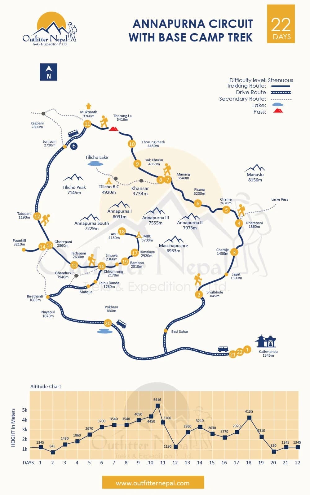
Trip Map
Day to day route map and altitude graph
Annapurna Circuit With ABC Trek Route Map
Cost Details
Good to know before trip booking
What's Included
  • Airport transfers by private vehicles
  • 2 nights’ accommodation in Kathmandu with breakfast
  • 1 night’s accommodation in Pokhara with breakfast
  • Ground transport (Kathmandu - Bhulbhule, Muktinath - Tatopani, Matque – Pokhara – Kathmandu)
  • All meals (breakfast, lunch, and dinner) while on the trek
  • Accommodations in basic mountain lodges or tea houses on the trek
  • A guide and potters (1 potter carries a total of 22 kg from 2 trekkers)
  • Paperwork, National Park Entry Permit, and TIMS card
  • Arrangement of emergency helicopter service paid by your travel insurance company
  • Down jacket, sleeping bag, and duffel bag – if necessary (return after trek)
What's not Included
  • Nepal Visa Fee (easily issuable upon arrival at Tribhuvan International Airport, Kathmandu)
  • Travel insurance (mandatory)
  • Meals (lunch and dinner at Kathmandu and Pokhara)
  • Personal expenses (snacks, drinking water, beverages, bar bills, etc.)
  • Laundry and telephone bills
  • Hot shower, hot drinking water, battery charging, internet charge while on the trek
  • Tips for guide and potters (expected)
  • Anything not mentioned in the Included section
Dates & Prices
Book your trip with confidence
Select a departure month
Showing Departure of Jan 2025
Starts: Friday
Jan 24, 2025
Ends: Friday
Feb 14, 2025
Price (Per Person)
US$1350
Availability
Guaranteed
Starts: Monday
Jan 27, 2025
Ends: Monday
Feb 17, 2025
Price (Per Person)
US$1350
Availability
Guaranteed
Starts: Friday
Jan 31, 2025
Ends: Friday
Feb 21, 2025
Price (Per Person)
US$1350
Availability
Guaranteed
  • We have a fixed departure date for the Annapurna Circuit with Base Camp Trek. So, select your date and book the trek.
  • If your preferred date is not listed, contact us to discuss the alternative dates and further process to book your preferred date, as the trek is available on any date of the year.
  • We have listed the price for up to 10 individuals. Please let us know if you are in a group of more than 10 people. We can manage a discounted group price for you.
  • Please reach out to us if you want to book a private trek. Private treks are available at any date of the year.
  • Solo trekkers are more than welcome to join the trek. While single people have a single room in Kathmandu & Pokhara, you have to share a room with fellow trekkers in the mountain lodges due to the lack of enough rooms and lodges in the remote Annapurna region.
  • Guaranteed dates are guaranteed to depart as we already have bookings for the date.
  • Available dates are available to book and become guaranteed once you book that date.
  • Closed dates are closed for booking and not bookable. However, contact us to discuss the alternatives if you are available only on that specific date.
  • The departure date or the first day of the trek is your arrival date in Nepal.
Useful Information
Good to know before you travel

Maximum Altitude

Our Annapurna Circuit with Base Camp Trek – 22 Days takes you through Annapurna Conservation Area, the largest protected area of Nepal that ranges in elevation between 790 meters and 8091 meters at the summit of the world's 10th tallest mountain peak, Annapurna I. Along the trail of 22 days, we go up and down, staying at varied altitudes. The Annapurna Base Camp sits at an elevation of 4130 meters above sea level, which is still not the highest point of the trek.

The maximum altitude we climb during the Annapurna Circuit with Base Camp is 5416 meters at Thorung La Pass. The pass is also famed as the highest trekking pass in Nepal. Furthermore, the highest elevation we stay at night is 4450 meters at Thorung Phedi, the base of the Thorung La Pass.

Trek Difficulty

Given the duration of the trek and the elevation gained, the 22 Days Annapurna Circuit with Base Camp Trek is categorized as strenuous. The trail is a good mix of difficult, moderate, and easy hikes. You will be ascending and descending multiple times, challenging your body to adjust to the changing oxygen level. Thus, there is a high risk of altitude sickness as you trek above 5000 meters above sea level.

Each day, you'll have to trek for 6-8 hours in the rugged Himalayan terrain, so you must have excellent mental and physical health. The uncertainty of weather conditions at high altitudes also adds up to the difficulty level. This 22-day Annapurna trek is obviously more difficult than other smaller treks in the Annapurna region. But nothing can stop a true adventurer.

Transportation

Apart from walking on the trail, the Annapurna Circuit and Annapurna Base Camp Trek include road transport at a few locations. In the beginning, we take a bus ride from Kathmandu to Bhulbhule. In the middle, we again take a jeep or a bus ride from Muktinath to Tatopani and resume the hike. At last, we travel on a local bus from Matque to Pokhara and a luxury tourist bus from Pokhara to Kathmandu.

Accommodation

Accommodations during the trip will be in a mountain lodge or a tea house, like any other trekking route in Nepal. These are modest, locally owned hotels that offer basic meals and rooms with 2 to 5 beds, depending on the room size. As a result, during the busiest trekking season, you might have to share a room with other hikers. You will get a comfy mattress, bed linens, pillows, and blankets in the warm rooms.

We suggest you carry your own toiletries for hygiene reasons, as you will have to share a common washroom at many locations along the trail, especially at higher altitudes. Also, get yourself familiar with Asian-style squat toilets because these are common at the lodges you'll be staying at.

However, lodging at Kathmandu and Pokhara will be provided in a 3-star hotel with complimentary breakfast.

Meals

You are free to eat whatever you choose while you're at Kathmandu and Pokhara, as lunch and dinner are not part of our package at these places. Both Lakeside in Pokhara and Thamel in Kathmandu provide a wide range of eateries serving multiple cuisines with veg and non-veg options. There are a handful of vegan restaurants as well.

The menus at the tea houses along the trekking route, though, won't have a lot of options. You'll be given Daal Bhat, a traditional Nepalese dish made of white rice, lentil soup, seasonal vegetables, salad, and pickles, for dinner and possibly lunch. Thanks to the food's high protein and carbohydrate content, you will have enough energy for the entire day's hike. The usual breakfast fare is tea, coffee, boiled eggs, curries, and Tibetan bread. Also, you can taste several regional dishes like noodles and momo.

Drink plenty of fluids like hot water and ginger lemon tea to stay hydrated and avoid altitude sickness.

Drinking Water

We discourage the use of plastic-bottled water due to the increase in plastic waste on the trail. Therefore, bring a thermos flask with you and fill it with hot water in the tea shops along the trail. You can use water purification tablets to cleanse your water if you're concerned with the purity of the water. The best option is to invest in a good bottle with a built-in filter system. You can fill it up with fresh water from natural sources while you're hiking.

Battery Recharge Facility

The tea houses along the trail provide a power supply to charge the batteries of your devices at some minimum cost. The tea house where you stay the night might provide the service without charge. Solar power provides energy for charging batteries and lighting rooms. You might face reliability issues due to less sunlight during winters and even in other months at high altitudes.

Carrying extra batteries with you is always the safest option. The batteries tend to drain out quicker due to cold, so minimize the use of your devices and keep them close to your body to keep them warm.

Network Connectivity on the trek

Let's not anticipate fast WiFi and excellent phone reception in the isolated remote areas of the Annapurna region. You won't really feel like connecting to the outer world while you're tucked in the heavenly world of the Himalayas. If it's essential, you may be able to get WiFi with patchy coverage at the tea shops along the route by paying an additional fee.

you can use mobile data anywhere you receive network coverage. Get a 4G SIM card from the NTC or NCell phone networks in Kathmandu before you head out for the trek. The NTC network is said to work better in remote areas.

Guide and Potters

The Annapurna Circuit with Base Camp Trek – 22 Days comes with a guide and potters.

Two hikers are paired with one potter, who carries a combined 20–22 kg from the two hikers. If you're an experienced trekker and comfortable carrying your own rucksack, you can avoid paying the potter's wage by doing so. But remember, this is not an ordinary trek. You'll be traversing through the rough trail at high altitudes of the Annapurna region for 20 long days. So, think twice before deciding not to hire a potter.

As per the guide, we strongly recommend you hike with a knowledgeable trekking guide that has led a team several times in the Annapurna and is familiar with the particular route's weather conditions. A skilled guide makes a big difference in the expedition's success as they can assist you in an emergency in addition to route navigation and communication with locals.

Permits Required

To embark on the Annapurna Circuit with Base Camp Trek - 22 Days, one must have these two permits:

  • Annapurna Conservation Area Project (ACAP) Entry Permit
  • Trekkers Information Management System (TIMS) Card

We will arrange these permits for you prior to the trek. The cost of our package also covers the purchase of these two permits, so you don't have to worry about it.

What should I pack for the 22-day-long trek?

Carry only what is necessary, as it is difficult for you and the potters to carry heavy weight at such high altitudes for weeks. The following is a list of some essential trekking equipment:

  • Hiking boots
  • Sandals/Crocs
  • Several sets of undergarments
  • Good quality down jacket and pants
  • Fleece jacket
  • Thermal wear
  • T-shirts and pants
  • Warm woolen clothes for the night
  • Trekking stick
  • One set of gloves
  • Woolen hat
  • Sunhat
  • Sunglasses
  • Sunscreen
  • Water bottle with purifying tablets
  • Toiletries
  • A medium-sized towel
  • Energy bars
  • Basic medications
  • Raingear
FAQs
Annapurna Circuit With ABC Trek - 22 Days frequently asked questions

The 22 days Annapurna Circuit with Base Camp Trek is best done in the spring (March, April, and May) and autumn (September, October, and November). These are the finest seasons for weather in the Annapurna region.

The scenery appears clearer than ever on sunny, warm days with brilliant blue skies, making for a beautiful hiking day. The weather in the lower altitudes is moderate, and cold in the high altitudes but not as cold as it gets in winter. The chances of rainfall and snowfall are also less in spring and autumn.

Altitude sickness, or Acute Mountain Sickness (AMS), is a common risk when trekking anywhere above 3000 meters. Although it affects every individual differently, headaches, shortness of breath, exhaustion, dizziness, and loss of appetite are some primary symptoms.

The symptoms can be controlled by drinking enough liquids, resting adequately, and eating a healthy diet. If the condition worsens, the patient should be immediately sent to a lower elevation. In severe cases, the patient will be rescued via helicopter and transferred to a fine hospital in Pokhara or Kathmandu.

There's no hard and fast way to prepare for any trek. You're good enough for the trek if you are mentally healthy and physically fit. Considering the long duration of the trek, it's better to have an earlier trekking experience in high altitudes. If not, you can start preparing by adding cardio routines to your daily schedule. Go for a run, swim, or hike around your town.

Usually, travel insurance covers delayed or canceled flight fares, lost baggage, and medical bills due to injuries while traveling. In the case of trekking in the high Himalayas, sometimes, there might come a situation where you should be airlifted by a rescue helicopter to save you from natural calamities or medical urgency. Travel insurance becomes a great help in such scenarios. So, make sure to get the insurance that covers helicopter rescues.

Yes, our trek package covers mountain lodge accommodation along with 3 basic meals per day (breakfast, lunch, and dinner) while on the trek. The additional expenses, such as snacks, drinking water, tea, coffee, etc., are at your own cost. So, carry some cash with you, as the remote lodges don't accept other payment methods.

The Annapurna Circuit with Base Camp – 22 Days trail has no ATMs. Make sure you withdraw enough money from Kathmandu or Besi Sahar because that is where ATMs are last to be found.

If you're traveling with cash from your country, you can exchange them for Nepalese currency in Kathmandu. There're plenty of money exchangers in Kathmandu, especially in Thamel, where our office is located.

For your safety, carry a kit with essential medicines like painkillers, tablets for diarrhea, cough syrup, band-aids, regular medication, etc., as you won't find any hospitals along the trek. And a basic illness may end the journey for you if you don't have medicines to treat it.

The streets of Thamel are full of stores that sell trekking gear. You'll get everything from hiking boots to rain gear in Thamel. The cost is also very affordable compared to the one in your country. Of course, the quality won't be premium, but they are made of local materials and work well for the weather and temperature of the Himalayas.

For sure! We are flexible enough to make any alterations to your trip plan and itinerary as long as you book a private trip. However, we aren't able to make alterations to the group departure trips as the changes might be unfair to others in the group.

Having been in the business for over a decade, we have a good understanding of what trekkers anticipate during their trekking journey. We, therefore, go above and beyond to fulfill those expectations. We secure all the permits beforehand so you can climb without fuss while our professional English-speaking guides look after you during the trek. Our top concern is keeping you safe and happy; our former guests would say the same.

If you have any inquiries about our services, please don't hesitate to send us a mail or a Whatsapp message. We're always at your service. See you soon in Nepal.

Add-ons Trips
You May Also Like
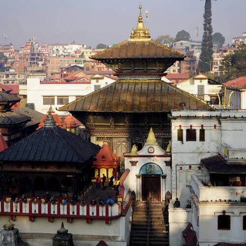
Kathmandu Day Tour
Duration: 1 Days
Starting from
US$45per person
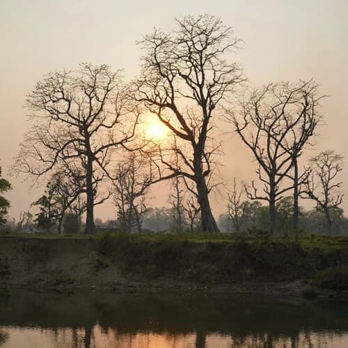
Chitwan Jungle Safari
Duration: 3 Days
Starting from
US$180per person
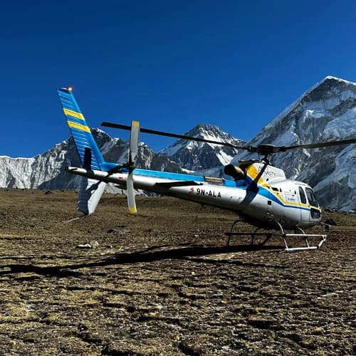
Everest Base Camp Helicopter Tour
Duration: 6 Hours
Starting from
US$1425per person
We’re Associated
  • Nepal Government
  • NTB
  • NMA
  • TAAN
  • himalayan rescue
  • KEEP
Need Help? Call Us.+977 9820996633